Matterport alternatives: 3D scan or 360° tour?
When you look for a Matterport alternative, the first decision is the technology, not the program. If you need to measure the space, produce a floor plan, or deliver a 3D model, your alternative is still a 3D scanning solution: laser scanning with the Leica BLK360, or Realsee, which scans with a 360° camera, a phone, or a LiDAR camera. If showing the buyer the rooms, the light, and the materials is enough, or if the project hasn’t been built yet, platforms that build tours from 360° photos and renders (Prewalk, Kuula, 3DVista, Panoee) do the same job with less equipment.
The Prewalk team wrote this guide, and Prewalk is one of the options on the 360° tour side. We took every fact about Matterport and the other products from each company’s own official page and checked it in November 2026. Plans and prices change often; before you decide, check the current details in the sources at the end.
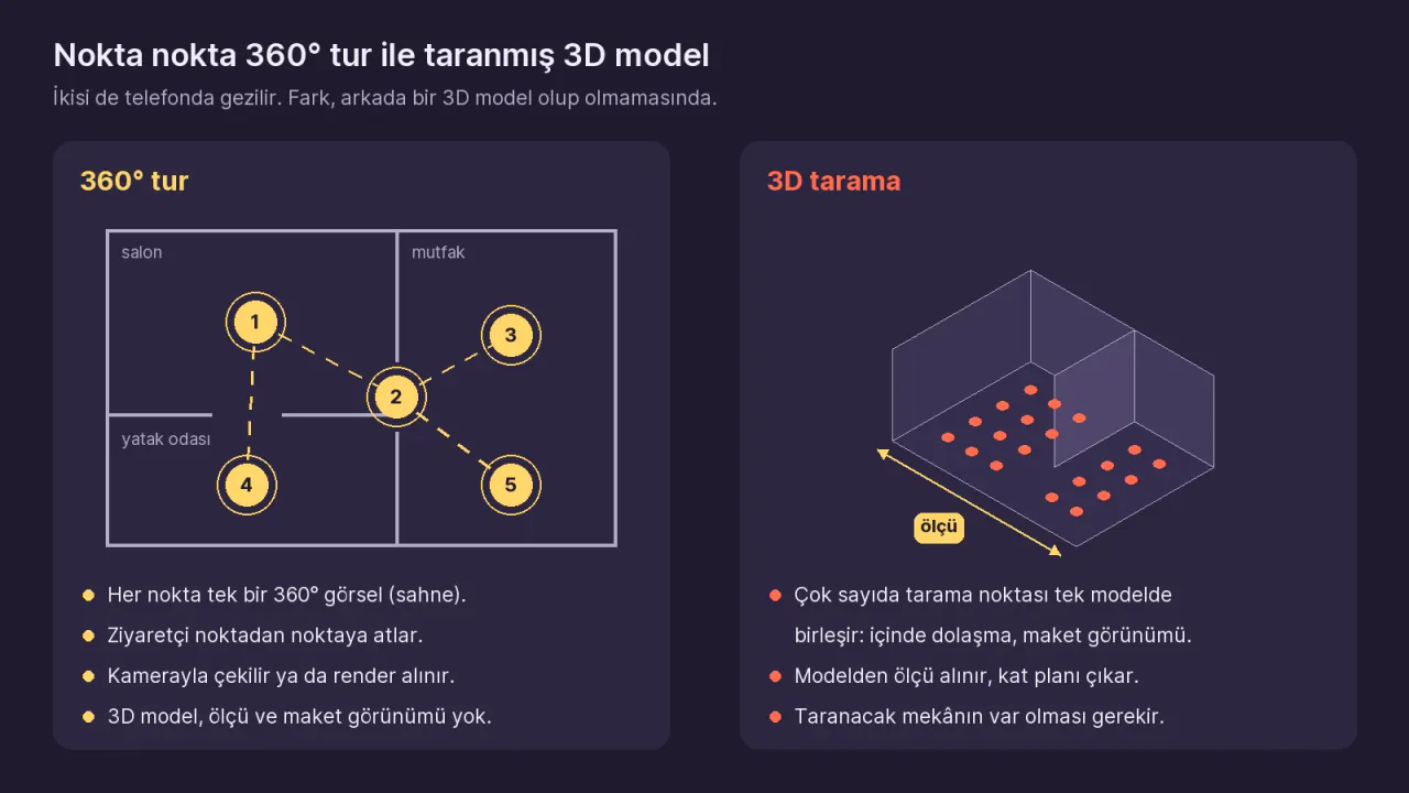
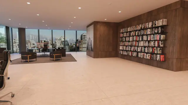
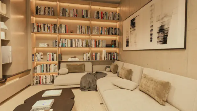
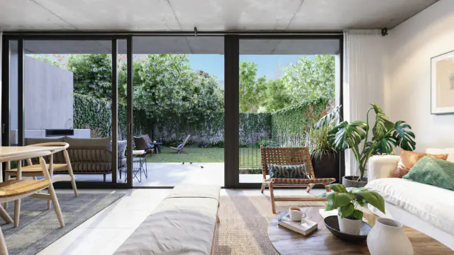
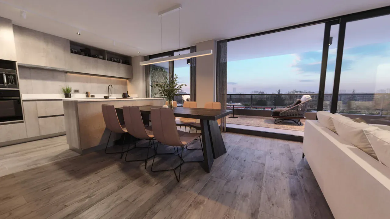
Tour note: This tour was made from 3D renders of an apartment; it isn’t a scanned model. Drag to look around, and click the rings on the floor to move between rooms. Each ring is a separate 360° image.
What does Matterport do, and where is it strong?
Matterport is a 3D scanning and digital twin platform. It scans a space from many points and merges those scans into a single 3D model that visitors can walk through. According to its official plans, cameras, and Pro3 pages, these are its strengths:
- Measurements. You can measure rooms, windows, doors, and furniture by clicking on the model. Room names and dimensions are generated automatically.
- 3D model and dollhouse view. Visitors walk through the model, and they can also see the whole building from the outside, like a dollhouse.
- Floor plans and technical files. Schematic floor plans, CAD, BIM, E57 point clouds, and MatterPak files can be ordered as add-on services.
- Automatic alignment. The camera comparison page lists 3D data registration (aligning the scans with each other) as “automatic” for the Pro3, Matterport’s LiDAR camera. According to the Pro3 page, the camera captures 3D data up to 100 meters away, and each scan takes less than 20 seconds.
- A large ecosystem. You can scan with the Pro3 and Pro2 cameras, supported 360° cameras, iOS and Android phones and tablets, and the Leica BLK360 G1. Models can be published to Google Street View and to US listing sites such as Homes.com, and there are integrations with construction and insurance software.
- VR. According to the plans page, Matterport models open in the Meta Quest browser with Enter VR.
We explain the core difference between the two technologies separately in 360° photos vs 3D scans. This guide focuses on why people think about moving away from Matterport, and on their options.
Why do people look for an alternative to Matterport?
Four reasons come up often. Below, we go through each one using the information on Matterport’s own pages.
1. The price depends on the number of Active Spaces
In November 2026, Matterport’s plans page lists two plans: Professional (10–500 Active Spaces, 10 users) and Enterprise (custom limits). According to the FAQ, the Free plan includes 1 Active Space and 2 users. An Active Space is a 3D model that can be viewed, edited, published, and shared. A large space counts as more than one Active Space:
| Scan points in a model | Active Spaces counted |
|---|---|
| 1–200 | 1 |
| 201–500 | 2 |
| 501–1,000 | 3 |
| 1,001–1,500 | 4 |
| 1,501–2,000 | 5 |
| More than 2,000 | 6 |
The Professional plan’s price changes with the number of Active Spaces you choose, and it appears on the plans page once you select that number. That’s why we don’t give a figure here; check the current amount on Matterport’s plans page. Here’s the math: every listing you keep live is at least one Active Space. For an office that shoots new listings every month, the cost ends up depending on how quickly it archives closed listings.
One more note if you have an older plan: the camera comparison page lists the old (Legacy) versions of the Starter, Professional, and Business plans separately. The plans page also says that legacy plans can’t be upgraded to the current plans at this time. Before you change your plan, check your account page or talk to Matterport’s sales team.
2. Once a Space is archived, its link doesn’t open
According to the FAQ on the plans page:
- When you reach the Active Space limit, new scans still upload, but they stay on hold until you upgrade the plan or archive older Spaces.
- An archived Space can’t be viewed, edited, published, shared, or transferred. The archive is unlimited and the Space isn’t deleted, but the link you put in your listing no longer opens.
- On the Professional plan, 2 reactivations a month (bringing a Space back from the archive) are included; after that, each one costs $20.
- A downgrade takes effect at the end of the current term, and you must stay within the Active Space limit of the plan you’re moving down to. There are no refunds for cancellations or downgrades.
Moving down to the free plan means keeping only 1 Active Space live. If you want the tours of listings still on the market to stay open, factor that in.
3. Equipment and time
Matterport no longer works only with its own camera. The camera page lists 360° cameras such as the Insta360 X5 and Ricoh Theta X; according to the plans page, you can also scan from an iOS or Android phone or tablet with the Matterport app. But for a measurable model, the space is scanned from many points close to each other, and that takes longer than a 360° tour with one shot per room.
Matterport’s own LiDAR camera is the Pro3. As of November 2026, the Pro3 page shows the camera at a price starting at $1,995, plus a subscription. According to the plans page, this Pro3 Plus bundle is sold together with a 24-month Professional plan with at least 50 Active Spaces.
4. Working with renders
Scanning needs a real space; an apartment that hasn’t been built yet can’t be scanned. Matterport’s plans page leaves a door open here: it says the Import 360 spherical images feature also accepts 360° images exported from unsupported cameras, DSLRs with panoramic heads, and virtual 3D environments. We haven’t tested what kind of model you get from renders (measurements, dollhouse view); check Matterport’s support documentation.
If your renders already come out as 2:1 panoramas, 360° tour platforms use those files as scenes with no extra processing. You can read how developers use these tours in their sales offices in our guide to using a 360° tour in pre-sale.
What are the Matterport alternatives for 3D scanning?
If what you deliver is measurements or a model, a 360° tour isn’t enough; you look at another scanning solution. Here are two options we could verify on their official pages, side by side with Matterport:
| Aspect | Matterport | Leica BLK360 | Realsee |
|---|---|---|---|
| Scanning hardware | Pro3, Pro2, supported 360° cameras, iOS and Android phones, Leica BLK360 G1 | BLK360 laser scanner and the Cyclone FIELD 360 app (iOS, Android) | Galois LiDAR cameras, Insta360 and Ricoh 360° cameras, phones |
| What does it deliver? | 3D model, dollhouse view, measurements; floor plans, CAD, BIM, E57 as add-on services | Point cloud and spherical images; E57 export, cloud sharing | 3D tour; point cloud, 3D model, CAD, and floor plan (some cost credits) |
| Pricing model (November 2026) | Subscription by the number of Active Spaces; 1 Active Space on the Free plan | Refers you to the sales team for pricing | No subscription, credits: 40 credits for US$120 |
| Best suited to | Real estate, facility management, insurance, construction documentation | Surveying and creating BIM models from scans | Photographers and real estate businesses that want to pay per tour |
Leica BLK360: laser scanning
According to Leica’s page, the BLK360 is an imaging laser scanner. With a single button press, it captures a full scan, spherical images included, in 20 seconds; its four 13 MP cameras shoot 5-exposure HDR. VIS (Visual Inertial System) technology pre-aligns the scans in the field. The data is uploaded to Leica’s cloud solution, Reality Cloud Studio, or exported as E57 and used in Scan-to-BIM (BIM models from scans) workflows.
What you should know: the Cyclone FIELD 360 app is free, but activating it requires a valid Cyclone REGISTER license. The price isn’t on the page; it refers you to the sales team. Leica’s page presents the product for construction sites, surveying, and Scan-to-BIM work. The first generation of the BLK360 (G1) is also supported as scanning hardware in Matterport.
Realsee: 3D tours with a 360° camera, a phone, or a LiDAR camera
Realsee sells its own Galois LiDAR cameras, but it also lets you capture 3D tours with Insta360 and Ricoh 360° cameras, and with a phone through the Realsee VR app. It says a single scan produces a point cloud, a 3D model, CAD, a floor plan, and high-resolution panoramas.
The pricing model differs from Matterport’s: there’s no monthly subscription; you buy credits. According to the credits page, in November 2026, 40 credits cost US$120; the unit price drops in larger packs. Capturing, uploading, editing, previewing, and storing are free. One credit creates a tour or keeps a tour active for 30 days; usage varies by capture method. One limit: phone, 360° camera, and gimbal projects allow at most 100 capture points, and Galois LiDAR projects 2,000.
What options are there on the 360° tour side?
If you don’t need measurements or a 3D model, 360° tour platforms do Matterport’s marketing job: the buyer walks through the rooms and sees the light and the materials. For someone coming from Matterport, the two most important differences are what the price is based on and what happens to the tour when the subscription ends:
| Platform | What is the price based on? | Official price (November 2026) | If the subscription ends or is downgraded |
|---|---|---|---|
| Prewalk | Number of scenes | Free: 30 scenes. Pro: $15 a month billed yearly, $19 billed monthly | Content isn’t deleted; scenes over the limit stay live, and new uploads stop |
| Kuula | Number of posts and features | Pro: $20 a month billed yearly, $24 billed monthly | According to its pricing page, data isn’t deleted when you cancel |
| Panoee | Storage | Free plan: unlimited tours, 3 GB. PRO: $22 a month | According to its FAQ, tours on the free plan stay live for as long as you want |
| 3DVista Virtual Tour Pro | One-time license | $499 or €499; hosting from €99 a year | The license is perpetual; you can also host the tour on your own server |
All of these platforms accept 2:1 panoramas. There’s no difference between a photo you take with a camera and a render you export from a 3D program. You’ll find a detailed comparison of features (VR, embedding, free plan limits) in our guide to the best virtual tour software, and the options for people coming from Kuula in Kuula alternatives. We work out the total cost, including the camera, labor, and hidden costs, in our guide to virtual tour prices.
Prewalk is a platform that turns 360° images, shot or rendered room by room, into tours that open from a single link and run in the browser on phones, computers, and Meta Quest. What stands out for someone coming from Matterport:
- A render becomes a scene directly. JPG, PNG, TIFF, or WebP, up to 8K (8192 × 4096) on the Free plan and up to 16K (16384 × 8192) on Pro and above.
- Real depth in VR. On every plan, the tour opens in the Meta Quest browser. On Pro and above, you can upload top-bottom stereo renders; regular (mono) 360° images look flat in the headset, while stereo renders show depth. The details are in our guide to VR tours.
- Your own floor plan. You can add your floor plan to the project page as an image and mark the rooms on it; when visitors click a marker, they go to that room’s 360° view. But Prewalk doesn’t generate floor plans or take measurements.
- Pricing by scene. A scene is a single 360° image. A two-bedroom apartment usually takes 8–10 scenes; by that math, the Free plan keeps about 3 apartments live at once, and the Pro plan about 50. All the plans are on the Prewalk pricing page.
When do you need a 3D scan, and when a 360° tour?
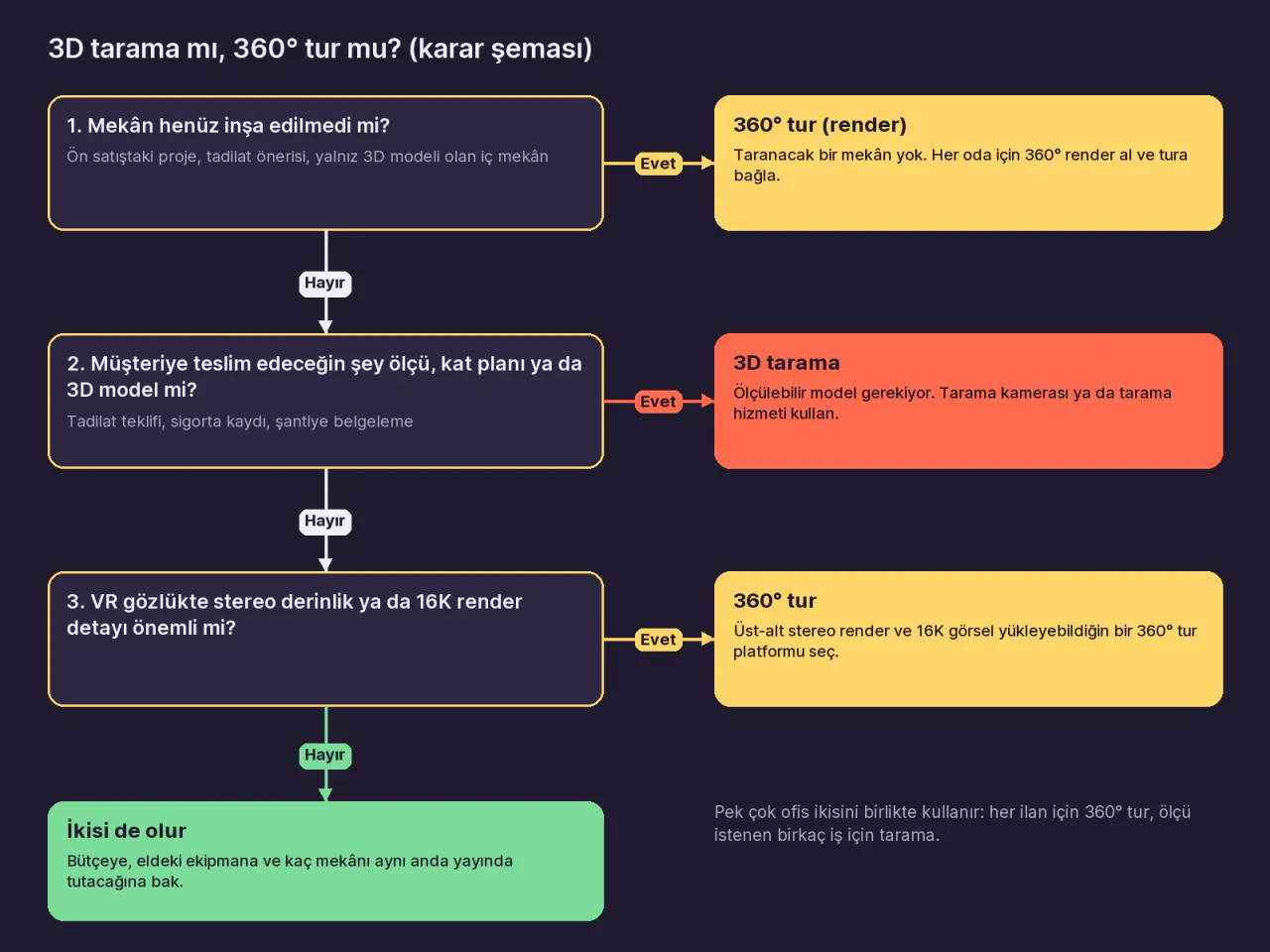
| Need | 3D scanning (Matterport, Leica, Realsee) | 360° tour (Prewalk, Kuula, 3DVista, Panoee) |
|---|---|---|
| Measurements, floor plan, 3D model | Yes. You take measurements from the model; floor plans and technical files can be produced | No. In Prewalk you can add your own floor plan and mark the rooms; it doesn’t measure |
| A project not yet built | Can’t be scanned. Matterport lists importing 360° images from virtual environments; check the result in its own documentation | 360° renders become scenes directly |
| Budget and billing unit | Active Space (Matterport), credit (Realsee), scanner license (Leica) | Scene (Prewalk), post (Kuula), storage (Panoee), one-time license (3DVista) |
| Equipment | A scanning camera or a laser scanner; you can also scan with a 360° camera or a phone, but the space is scanned from many points | A 360° camera that takes one shot per room, or a rendering program |
| Stereo depth in VR | Matterport models open in VR in the Meta Quest browser; check Matterport’s VR documentation about depth | In Prewalk, Meta Quest on every plan; real depth with top-bottom stereo renders on Pro and above |
| When publishing ends | In Matterport, an archived Space can’t be viewed; reactivating it costs extra once you go past your plan’s allowance | In Prewalk, downgrading your plan doesn’t delete content |
Many real estate offices use both: a 360° tour for every listing, and a scan for the few jobs that need measurements. When you set up your office’s shooting routine, the decision chart in our guide to virtual tours for real estate agents will help.
What should you watch for when switching from Matterport to 360° tours?
- Separate the jobs that need measurements. Don’t drop scanning for jobs that involve renovation, insurance, or technical deliverables. Move the rest of your listings to 360° tours.
- List your live links. When you archive a Space in Matterport, its link stops opening. Don’t archive the Space before you’ve put the new tour link in the listing, on your website, and in your QR codes.
- Check your camera. If you bought an Insta360 or Ricoh 360° camera for Matterport, and the camera’s app can export the full 360° photo as a 2:1 equirectangular JPG, you can use the same camera for 360° tours too.
- Plan your points from the start. The placement the scanning software used to handle is now up to you: at least one point per room, plus extra points in hallways and doorways.
- Try it with a single listing. Shoot one home, turn it into a tour, and send the link to a buyer. The step-by-step method is in the guide How to make a 360° virtual tour.
When can’t Prewalk replace Matterport?
Prewalk doesn’t create 3D models, doesn’t measure rooms, doesn’t generate floor plans from photos, and doesn’t show a dollhouse view. Visitors look around only from the points where the camera stood; they can’t move freely between points. If what you deliver is a measured model, BIM, or a point cloud, use a scanning solution: Matterport, Leica, or Realsee. Prewalk doesn’t produce images either; the camera or the render comes from you.
Frequently asked questions
Can you use Matterport for free? According to Matterport’s FAQ in November 2026, the Free plan includes 1 Active Space and 2 users. To keep more than one listing live at the same time, you need to move to the Professional plan.
Can I upload renders to Matterport? The plans page says the Import 360 spherical images feature also accepts 360° images exported from virtual 3D environments. Check Matterport’s support documentation to see what the result looks like. On 360° tour platforms, a render becomes a scene the same way a photo does.
Does Matterport work with a 360° camera? Yes. The camera page lists many 360° cameras, including the Insta360 X5 and Ricoh Theta X; according to the plans page, you can also scan with a phone. You can use the 2:1 panoramas you shoot with the same camera on a 360° tour platform too.
Does a 360° tour open in a VR headset? On every plan, Prewalk tours open in the Meta Quest browser without installing an app. Regular 360° images look flat in the headset; for real depth, you upload top-bottom stereo renders on Pro and above.
Next step
Pick one of the listings you keep live on Matterport, shoot the same home with a 360° camera, and turn it into a tour in Prewalk Studio on the Free plan. Open the two links side by side and decide which one is enough for that listing. To compare programs, see our guides to the best virtual tour software; for the total cost, virtual tour prices; and for the core difference between the two technologies, 360° photos vs 3D scans.
Brand note: Matterport, Pro3, Leica, BLK360, Cyclone, Reality Cloud Studio, Realsee, Galois, Insta360, Ricoh, THETA, Kuula, Panoee, 3DVista, Google Street View, Homes.com, and Meta Quest are trademarks of their respective owners. This guide was written independently; Prewalk has no partnership with these companies, and they have not endorsed it.
Sources
- Matterport, plans, comparison table, and FAQ (Active Spaces, archiving, reactivation, refunds, supported cameras, Import 360 spherical images, VR) (November 2026)
- Matterport, camera comparison page (Pro3, 360° cameras, phones, plan compatibility) (November 2026)
- Matterport, Pro3 (LiDAR, range, scan time, price) (November 2026)
- Leica Geosystems, BLK360 imaging laser scanner (November 2026)
- Realsee, home page (Galois cameras, capture with a 360° camera and a phone) (November 2026)
- Realsee, Realsee Credits (credit prices, free actions, capture point limits) (November 2026)
- Kuula, pricing (November 2026)
- Panoee, pricing and FAQ (November 2026)
- 3DVista, store (November 2026)
- Prewalk, pricing
- Prewalk, FAQ (file types, stereo, VR, limits)
Share: Share on X LinkedIn WhatsApp